skip to Main Content

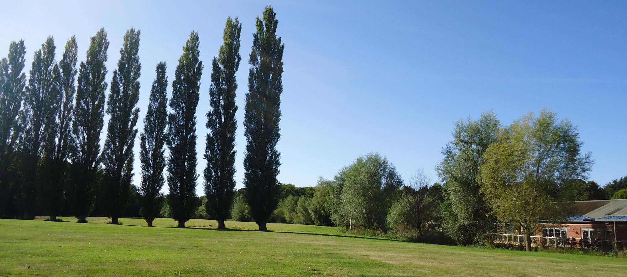
Phase 1 survey of a brownfield site

phase 1 brownfield site

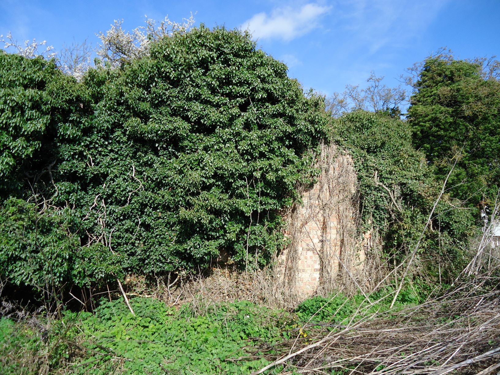
Derelict buildings sometimes require bat roost assessments

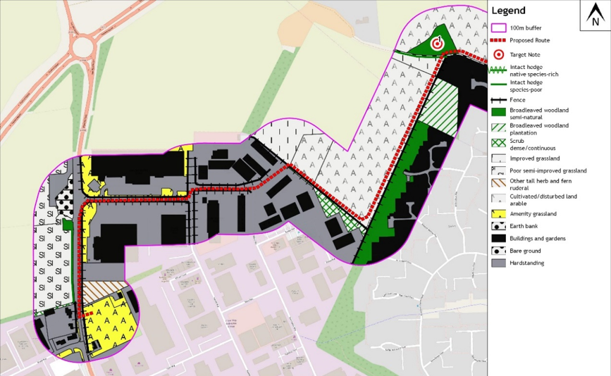
An extended Phase 1 Habitat Survey was commissioned for a site in south Norfolk. The site consisted of 0.3ha of unused land, including an old dilapidated building and several trees with bordering woodland, farmland and existing development. WFE undertook a site survey to classify the habitats to JNCC standards, and with the methods being ‘extended’ to include a general evaluation of potential habitats for any protected or valued species. The habitats on the site and surrounding area were classified, hedgerows were appraised, buildings and trees were inspected for bats and considerations were made concerning other protected species.

All the information we collected was mapped, supported by target notes and photographs detailing protected species issues. Further protected species issues were ruled out in this case and this fed into a final report for planning. If further surveys had been necessary, WFE could have produced what is known as a Preliminary Ecological Appraisal (PEA) and a final report produced after necessary surveys had been completed.

A new water pipeline at Thetford

  • January 27, 2020
  • Blog

In 2018 Wild Frontier Ecology undertook an extended Phase 1 habitat survey along a proposed water pipeline route around Thetford in Norfolk. The route was proposed to go through an industrial estate, agricultural fields, pastures, grasslands, hedges and trees.

To assess the habitats along the route, and the potential for any impacts on protected species, Wild Frontier Ecology first carried out a desk survey. This comprised a search for conservation sites within 2km of the proposed route and a data search with the Norfolk Biodiversity Information Service for species records. Fourteen statutorily designated nature conservation sites and 16 County Wildlife Sites were found with three of the County Wildlife Sites directly intersecting the route. 6,450 species records, including reptiles and a variety of bird species were also found within the 2km buffer.

Next the route was subject to a walkover survey where all habitats within a 100-250m buffer of the proposed pipeline were mapped and considered for their potential to host protected species such as great crested newts, reptiles and stone curlews. Ponds were also recorded and assessed for their suitability for great crested newts.

phase 1 water pipeline

An excerpt of a Phase 1 Habitat Map for the pipeline route

Based on the findings of the habitat survey, the client was advised that further great crested newt, reptile and stone curlew surveys should be undertaken to ensure impacts on these species were fully considered. No great crested newts were found in any of the surveyed ponds, a population of grass snakes was recorded at one County Wildlife Site and a stone curlew nest recorded just to the north of the route.

phase 1 water pipeline

Adam contemplates an early bath

Subsequent advice on how to avoid the recorded ecological features allowed the client to opt for directionally drilling under the County Wildlife Sites.

Wild Frontier’s final report then summarised the anticipated ecological impacts for the purposes of planning. Tailored construction methods and seasonal restrictions to the work were advised based on the survey findings. Altogether the package of survey works and clear practical advice meant that the project was assessed to have a neutral ecological impact in the long term, fulfilling the client’s ecological obligations.

NVC surveys of a SSSI

WFE was commissioned by Norfolk Wildlife Trust to conduct an NVC survey of an extensive SSSI in central Norfolk – Rush Meadow. This is a substantial area of swamp, wet woodland and species rich grassland recently acquired by the Trust. The NVC survey was required to inform management decisions and influence grazing and scrub removal.

The site was examined using aerial photographs, and divided into areas of homogeneous vegetation. These areas were ground-truthed and quadrat sampled over several visits. Although visits were undertaken in good weather, there were treacherous ground conditions across the site and copious biting insects – a bit like the jungle had come to Norfolk!

The data was analysed using a number of different tools, including the NVC volumes, constancy tables and statistical tools to provide satisfactory assessment of vegetation communities. The final maps show complex geographical patterning through the site, with several important vegetation communities demonstrably present.

NVC survey

The final NVC map of Rush Meadow SSSI showing the complexity of habitats on the site

Assessing invertebrates along a new road route

Wild Frontier Ecology was commissioned to provide an assessment of invertebrate populations along the route of a new road scheme in Norfolk. The entire route was walked and appraised for habitat quality, and subsequently four selected areas were investigated in depth for terrestrial invertebrate diversity.

assessing invertebrate populations

Invertebrates sampled are brought back for identification

Vacuum sampling, sweep netting, aerial insect netting and beating tray sampling were used to collect specimens. These were preserved and identified using the relevant literature and online resources.

Over 380 species of invertebrate were recorded across four selected sites along the route. The assemblages were analysed using the Pantheon online tool, and the sites were assigned a geographic value. This led to a balanced assessment and proposal of suitable mitigation strategies for the scheme, including potential net gain scenarios.

Arboricultural report for 10km pipeline in Thetford

A project to install a new water pipe around the perimeter of Thetford was being designed. Wild Frontier Ecology were able to survey all the trees, groups, hedges and woodlands along the route to provide maps of these features. Within the zone of influence of the development around 200 individual trees were surveyed, as well as around 30 groups/woodlands and more than 10 hedgerows. WFE appraised the arboricultural value of these trees and any potential impacts from the proposal. Possible impacts such as root damage and removal of trees/hedgerows were identified.  

Trees Thetford pipeline

An impact assessment was carried out for trees along the pipeline route

Using WFE’s findings, the scheme was designed to minimise the impacts on trees. WFE provided advice on suitable mitigation methods such as tree protection fencing and ground protection. Methods of construction, tree protection and on site ‘tool box talks’ were also advised to ensure the identified trees were protected throughout the project.  

By working with the client from the early stages, WFE were able to minimise arboricultural impacts without delays to development.

Back To Top